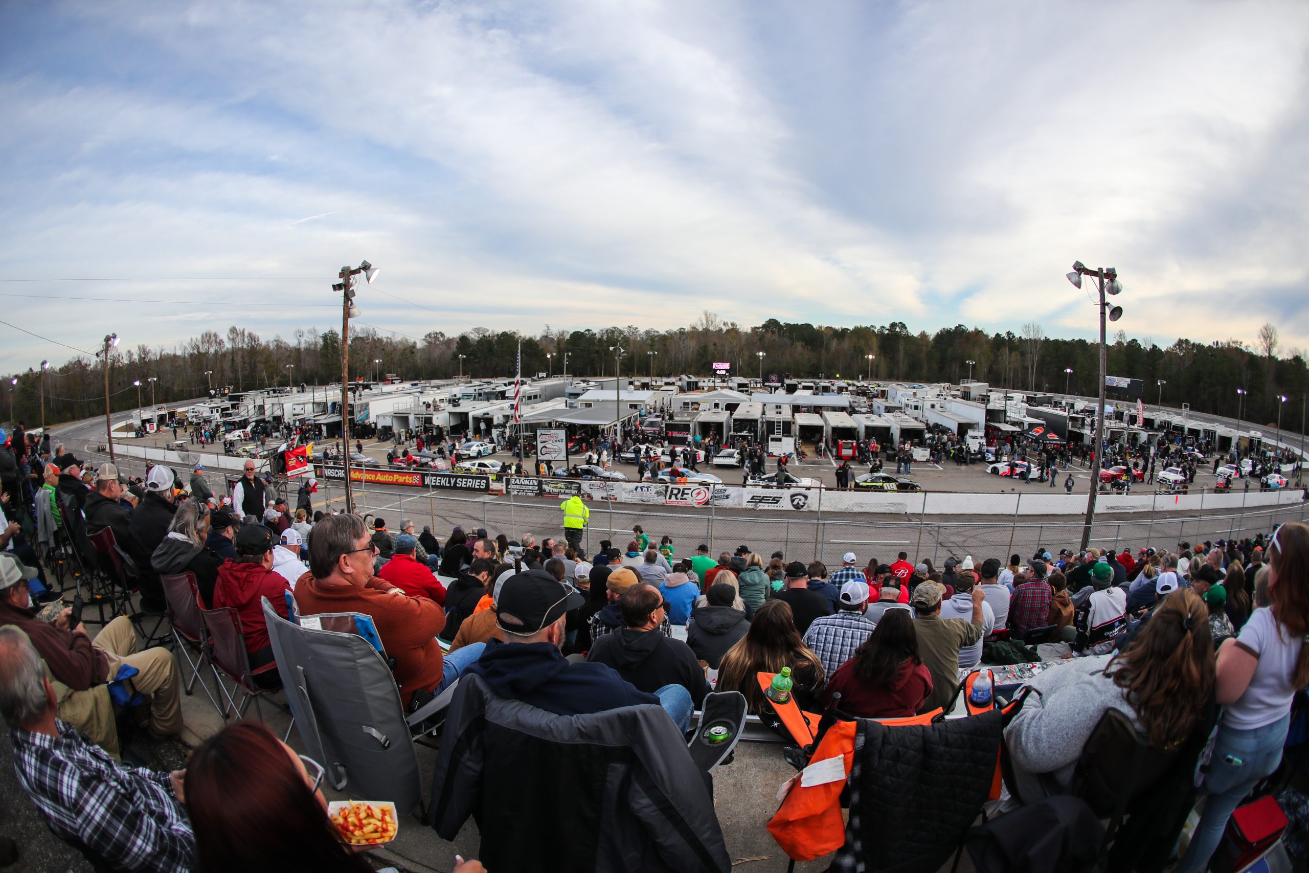
An impactful coastal storm will track towards eastern South Carolina heading into the weekend, with its impacts already being felt for South Carolina 400 Weekend with adjustments to the schedule made.
As of 1PM Friday, the storm system is weak along the Florida coast, and will continue to shift northward as we head into Friday night.
Taking a closer look at the weather for Saturday, the latest modeling data suggests it will be a very close call for racing activities at Florence Speedway. Temperatures will be in the lower to mid 60s, with winds out of the east/northeast around 10-15 mph, with gusts to 25 mph at times.
The chance for isolated showers will be possible throughout the morning on Saturday. Showers or light drizzle will be possible even from sunrise onwards across the Timmonsville, South Carolina area, as low-level moisture increases with east/southeast flow off the ocean.
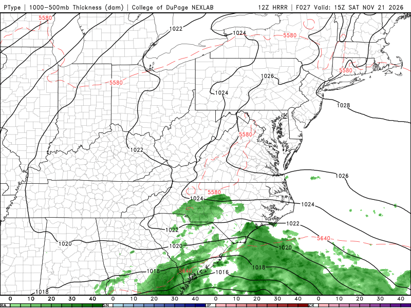
(Image: https://weather.cod.edu/forecast/)
With this east/southeast flow, there will be a chance for isolated to scattered showers or periods of drizzle to move across the I-95 corridor of South Carolina throughout the morning, but chances remain on the lower side.
Overall, any rain showers that fall in the morning through noontime on Saturday will be lighter, until better dynamics arrive later Saturday.
The chances for periods of drizzle or light rain showers making it into the Florence Speedway area remain low until around 12PM local time, after that, the chance for periods of drizzle/showers do increase across the area.
The storm system along the Florida coast will shift northward through the day on Saturday, bringing better dynamics northward by later Saturday afternoon across the Timmonsville area.
The later into the afternoon we get on Saturday, the chances for steady rain will increase starting around 2PM and later across the area.
The air-mass associated with this storm system will be ripe with tropical moisture, as precipitable water values will be elevated, increasing the chance for heavier rainfall rates with the steadier rain that arrives later Saturday afternoon/evening.
Starting around 3-5PM, chances for rain across the area will become more likely, with more scattered to widespread showers likely as we head into the evening. There is a chance for isolated thunderstorms later Saturday night and overnight into Sunday morning.
Heading into Sunday, a secondary low develops off the coast of the Carolinas and heads northward through the day Sunday. This will track away from the region, dragging drier air southward by later Sunday afternoon/evening.
Stay tuned with additional updates with meteorologist Stephen Durham
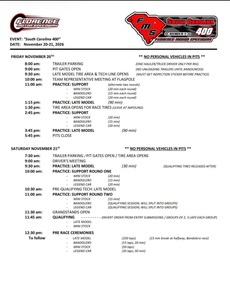
The current event schedule is below.



Late Model Stock Cars
South Carolina 400 latest forecast


Monaco Modified Tri-Track Series
Modified Tour team owner and Series operator Wayne Darling passes away

NASCAR Whelen Modified Tour
NASCAR sends 2027 rules to Modified Tour teams


Late Model Stock Cars
Florence hires accused domestic violence perpetrator as South Carolina 400 announcer